Articles in the Hiking Routes Category
Attractions, Bicaz Gorges - Hăşmaş National Park, Hiking Routes, Tourist Routes in Bicaz Gorges »
To climb on the peak Suhardul Mic (The Peak Little Suhard) and to reach the belvedere point from where you can see the entire Lacul Rosu resort you can go on the to the touristic route marked with a blue triangle on a white background. This route starts in the resort Lacul Rosu and goes toward the Bucur Vila, Suhard Cabin, Saua Suhard and up to the wooden cross on top of the Peak Suhardul Mic, at an altitude of 1345 m. the route is accessible to all tourists and …
Ceahlău National Park, Hiking Routes, Nature Parks, Touristic Routes in Ceahlău Massif »
The complete tour goes up to Dochia Cabin and the bookmark is red cross on white background. Here is the list of points through which the route goes:
Durau (800 m) – Steofan’s Plain – In Vesuri (1200 m) – Duruitoarea Waterfall (1210 m) – Polita Scaius (1400 m) – Piciorul Schiop (1780 m) – Dochia Cabin (1750 m)
The altitude difference is 995 m and the length of the route is 7.5 km. the approximate time for this route is 4 – 5 hours. In winter the route is accessible only …
Attractions, Bicaz Gorges - Hăşmaş National Park, Hiking Routes, Nature Parks, Other Articles, Tourist Routes in Bicaz Gorges »
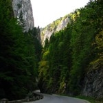
Location: Cheile Bicazului – Hasmas National Park is located in Hasmas Mountain, in the central-north-east area of Romania. The protected area is crossed by the road DN 12C which makes the connection between Gheorgheni and Bicaz
Geographical data
Geographic location: the central part of the Eastern Carpathians
Altitude: 670 – 1792 m
Area: 6,575 ha
Short description of Cheile Bicazului – Hasmas National Park
Thanks to the impressive size of this natural monument called Cheile Bicazului this is one of the most interesting areas of the country. The natural borders of this protected area are represented …
Attractions, Ceahlău National Park, Hiking Routes, Nature Parks, Other Articles, The Legends from Ceahlău Massif, Tourism Promotion, Tourist trails, Touristic Routes in Ceahlău Massif »
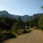
Location: Ceahlau National Park is located 10 km west of Bicaz and its borders are between Bistrita Valley, Bistricioarea Valley and Bicaz Valley.
Geographical data
Geographic location: centre of the Eastern Carpathians
Location: 47 degrees latitude N, 26 degrees longitude
Area: 290 square km
Ceahlau Massif is the tallest of Bistrita Mountains and it represents the biggest touristic attraction in the Eastern Carpathians. Considered by the Dacia people to be home of their god Zamolxix, the ancient name of this mountain is Pion (Peon) which means “the pillar of the house”. This is the mountain …