Hiking / trekking
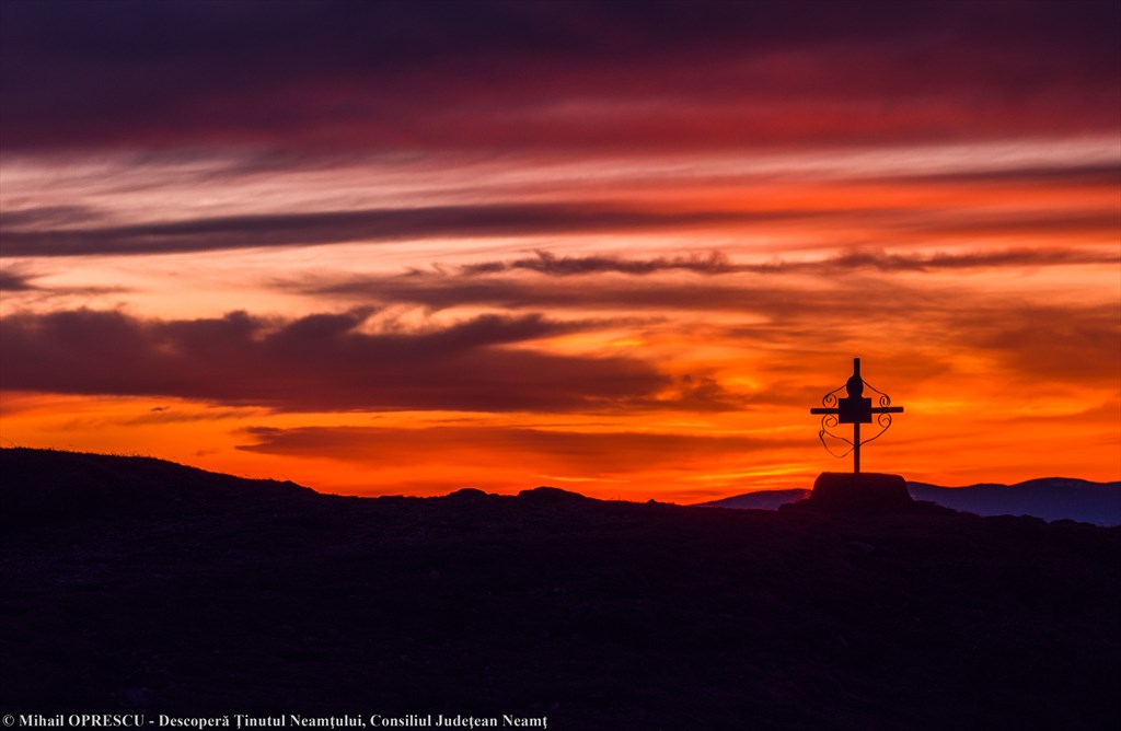
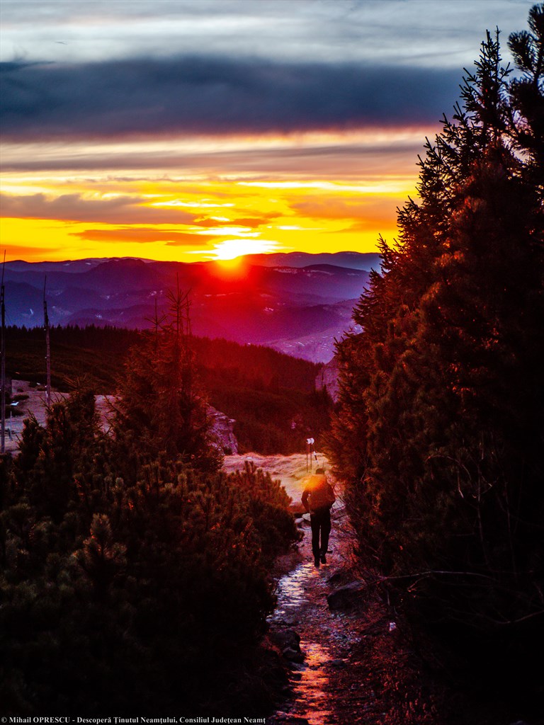
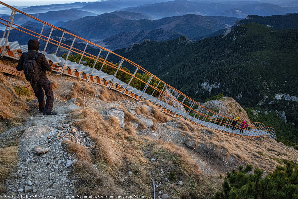
Ceahlău National Park
Hiking on the marked trails in Ceahlău National Park
A true natural fortress, the Ceahlău Massif offers visitors dreamy landscapes with deep forests, junipers and alpine meadows, gentle slopes and rocky cliffs, chimneys, gutters and troughs, gentle streams and rapids, waterfalls, isolated peaks and natural rocks, , historical relics and architectural monuments.
Information on the routes on Ceahlău Massif, access fee, etc .:
Ceahlău National Park Administration Department: telephone / fax 0040233 256 600, +40.728.963.543; e-mail: [email protected];
GPS coordinates: N 46.948959, E 25.939587
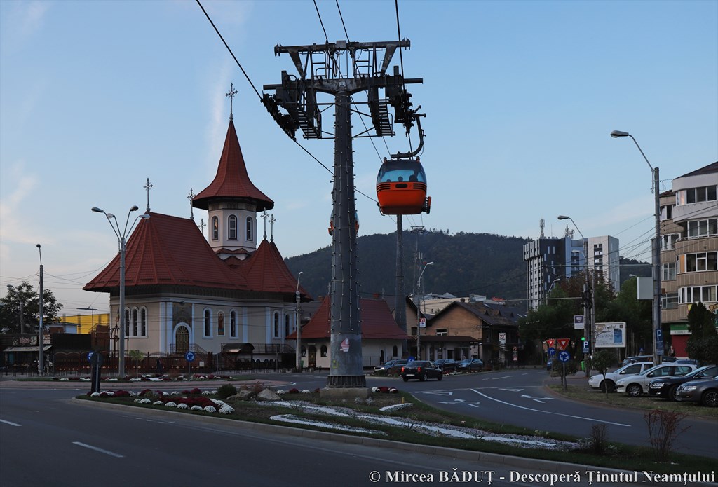
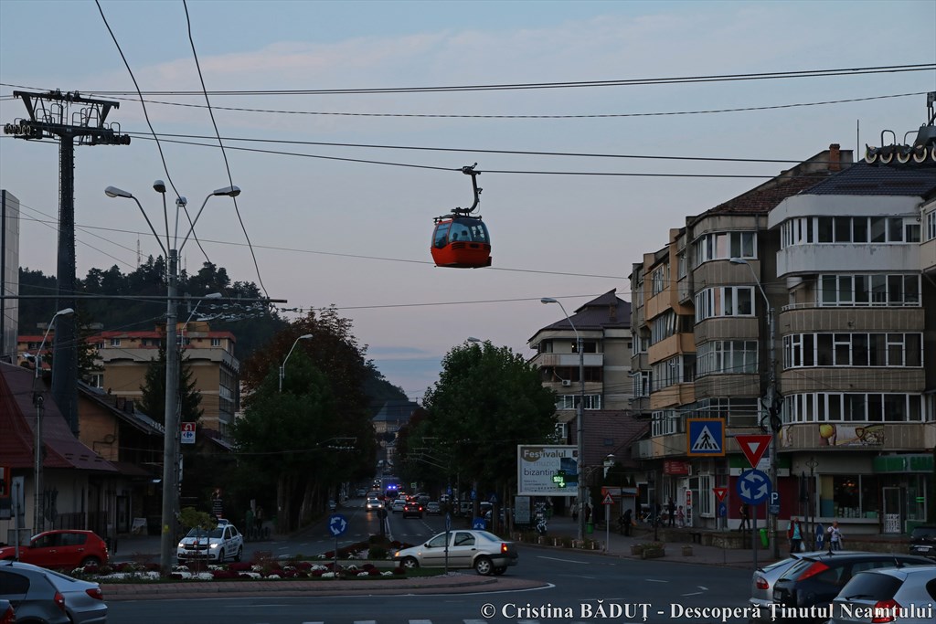
Hiking on Cozla Hill
Arranged on the Cozla hill, in the northern part of the city of Piatra Neamț, the Cozla leisure complex is arranged in successive terraces, where the restaurants “Colibele Haiducilor” and “Cercul Gospodinelor” are located. At the base of the park is a small zoo. At the top of Cozla Hill are the cable car arrival station, the toboggan run, the ski run departure point and the ski lift arrival station, used by skiers.
Contact details: +40.724.538.928
Stop by on the shores of the lakes located on both sides of the national road 15, in the Pângăraţi and Vaduri villages.
Cable car contact details: +40233 222 011 // +40.724.538.928 // [email protected]
http://telegondolapiatraneamt.ro/
GPS coordinates: N 46.927724, E 26.361340
Cozla Leisure Complex
Tel: +40.233.233.845
GPS coordinates: N 46.935887, E 26.370537
Gârcina commune
Hiking on the marked route to the shores of Lake Cuejdel, a picturesque view, impressive in every season. Tourists can reach the area either by car, on a forest road or through Gârcina commune, traveling 25 km from Piatra Neamţ by car and then 3 km, on foot, on a wide path, through meadows and deciduous and coniferous forests.
Stop by on the shores of Lake Cuejdel, which you can reach either by car, through Crăcăoani commune, on a forest road, or through Gârcina commune, traveling 25 km from Piatra Neamţ by car and then 3 km, on foot, on a wide path, through meadows and deciduous and coniferous forests.
Lake Cuejdel GPS coordinates: N 47.035423, E 26.216787
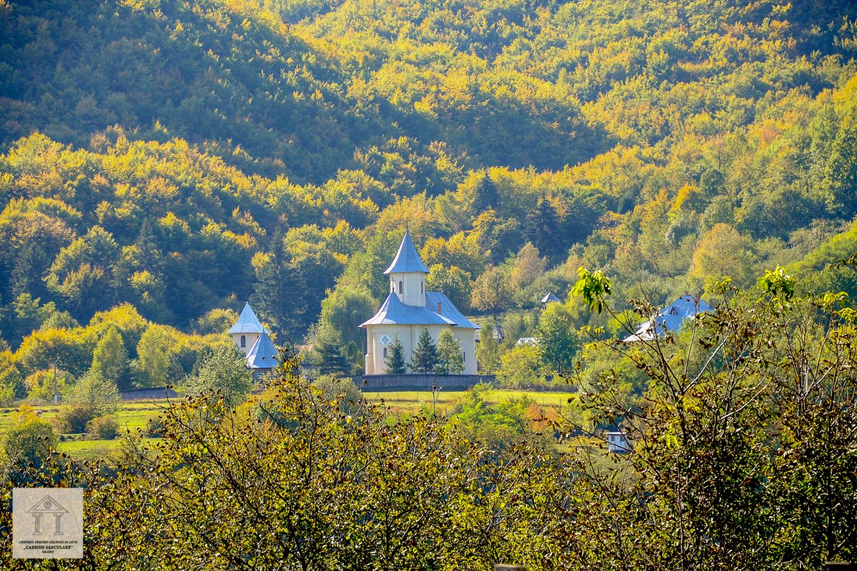
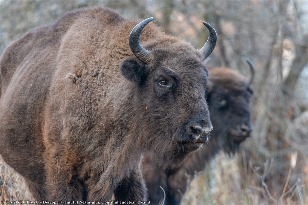
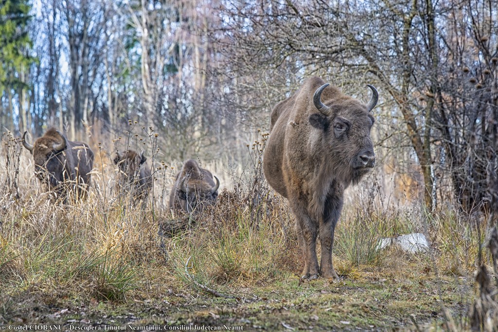
Vânători Neamț Natural Park Area
Hiking on the routes from Vânători Neamţ Natural Park. Register in the tourist programs offered by the Administration Department of Vânători Neamţ Natural Park, tel. +40233 251 060, http://www.vanatoripark.ro
• Hiking on marked routes in Bicaz Gorges – Hăşmaş National Park; information can be obtained from the Park Administration Department: tel / fax 0266 336 540, [email protected], [email protected]
• Hiking on marked trails in Ceahlău National Park (on the trails starting from Bicazu Ardelean, Neagra, then Ceahlău Massif and Durău); information can be obtained from the Park Administration Department: tel / fax 0233 256 600, [email protected]
• Stops by at the chalets in the Ceahlău Massif: Fântânele Chalet, tel. +40730 603 803; Dochia Chalet, tel. +40730 603 801, +40730 603 802, fax +40233 256 577, [email protected].
• By car, motorcycle or bicycle you can turn 8 km from DN 15, on the left before reaching the Bicaz Dam, to admire an impressive overview of the Ceahlău Massif and stop by at lzvoru Muntelui Chalet, tel. cottage +40746. 906 522.
Parcul Natural Vânători-Neamţ
Tel: +40.233.251.060
GPS coordinates: N 47.166123, E 26.202549


Leave your response!