Articles in the Tourist Routes in Bicaz Gorges Category
Bicaz Gorges - Hăşmaş National Park, Entertainment, Other Articles, Tourist Routes in Bicaz Gorges »
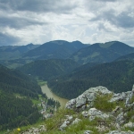
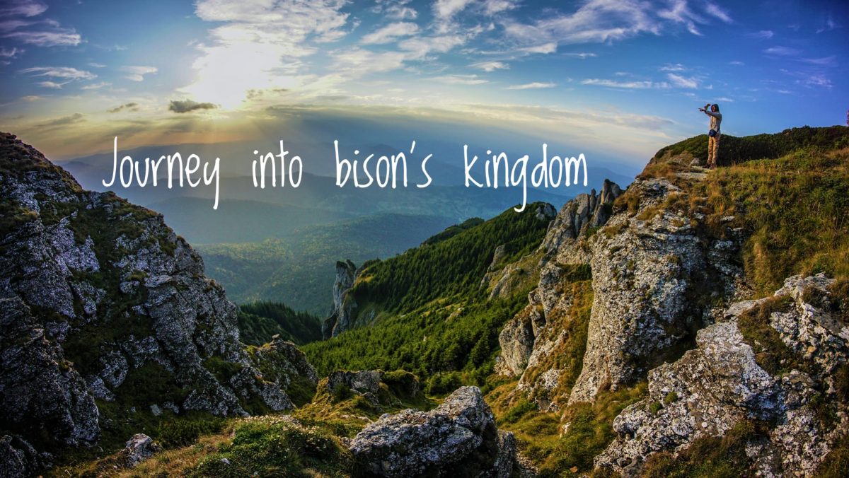
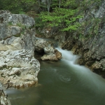
The entire area from Cheile Bicazului – Lacul Rosu represents an attraction point of great touristic importance for tourists that come each year to admire the beautiful natural stones that nature created here. The 8 km of twisted road that crosses Cheile Bicazului are spectacular: the scenery is unique.
Cheile Bicazului is a place that waits you to discover it: wild sceneries are hidden behind tall stone walls that seem to touch the sky. The narrow space between the 200 m stone walls, the twisted road, the waterfalls, numerous caves are …
Bicaz Gorges - Hăşmaş National Park, Hiking Routes, Tourist Routes in Bicaz Gorges »
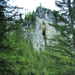
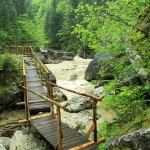
“Pestera Tunel” (The Tunnel Cave) is located in Cheile Sugaului – Munticelu Nature Reserve and crosses the mighty ridge “Piatra Glodului” (The Mud Stone). Also called by locals “Pestera Sura Glodului” (The Mud Burn’s Cave) the cave it’s like a tunnel carved into the massive stone wall by nature. Huge boulders were dislocated by a natural cataclysm and shaped this impressive passing through the stone wall.
The trail to “Pestera Tunel” (The Tunnel Cave) starts at the entrance in Cheile Bicazului, on the right, where Cheile Sugaului – Munticelu Reservation starts. …
Bicaz Gorges - Hăşmaş National Park, Hiking Routes, Tourist Routes in Bicaz Gorges »
Cheile Bicazului – Hasmas National Park is a spectacular area from Neamt County with numerous hiking trails. Behind the rock walls that surround the road DN 12C opens a world full of wonderful sceneries, haystacks and simple people that live their lives by rules forgotten by us who live in towns. The route that follows goes up through Cheile Bicajelului and reaches Lacul Rosu Resort by traveling on the road Drumul Surducului.
The route starts on the road DN 12 C, at the point called “Podul Ungurilor” – “Hungarians Bridge”, located …
Bicaz Gorges - Hăşmaş National Park, Hiking Routes, Tourist Routes in Bicaz Gorges »
One of the most spectacular hiking routes in Cheile Bicazului starts at the Stone “Piatra Altarului”: that big pointy rock with a cross on top of it. The hiking route goes through Lapos Canyon, a left side affluent of Bicaz Creek. The starting point of this route is located right after the exit from the tunnel, on the left, in the parking organized by Neamt County Council. Here you can leave your car.
Crossing the street, the hiking route starts with a red triangle marking. After a short steep hike you …
Bicaz Gorges - Hăşmaş National Park, Hiking Routes, Tourist Routes in Bicaz Gorges »
The center of Lacul Rosu Resort (967 m) – saua Piatra Rosie – Ghilcos Plane – Belvedere Piatra Ghilcos (1378 m)
Marking: red triangle
Time to make the route: 2 hours
Distance: 4 km
Level differences: 411 m, an easy route to make all year long
The hiking route starts from DN 12 C, which goes through Cheile Bicazului, at the point where the forest road Bicajel starts. The trail goes up in the forest in a slow slope and before it reaches Piatra Rosie it becomes abrupt and full of stones. The trail becomes …
Bicaz Gorges - Hăşmaş National Park, Hiking Routes, Tourist Routes in Bicaz Gorges »
Cheile Bicazului (850) – Lapos Canyon – Cupaş Planes – Saua Cupaşului (1275) – Cheile Bicazului (850) (circular route)
Marking: red triangle, from Saua Cupaşului red circle
Time to make the route: 3 hours
Distance: 5 km
Level difference: 425 m, difficult to make during winter
During winter this hiking route is difficult to make and we recommend full equipment in order to enjoy the beauty of the mountain fully secured.
The route starts at km 29 from the National Road 12C and the markings are red triangles (the starting point is localized right after the …